How to reach Padum
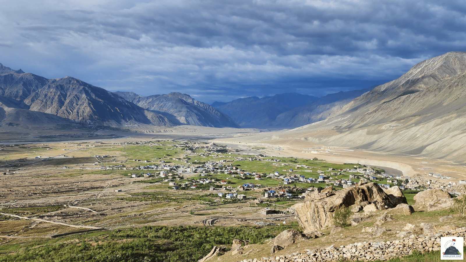
Padum, Zanskar's main town at about 3,670 m, is linked by road to Leh, Kargil and Manali. Pensi La on the Kargil road is usually snowbound from about November to late May or mid-June; acclimatise in Leh first.
Region: Zanskar
Route hubs: Leh - Nimmu - Chilling - Nerak - Zangla - Padum
Nearest airport
Kushok Bakula Rimpochee Airport, Leh (IXL)
180.00 km • About 8 hr
Nearest railhead
Srinagar railway station (Nowgam), Srinagar (SINA)
440.00 km • About 16 hr
From the airport
The nearest airport is Leh's Kushok Bakula Rimpochee Airport (IXL), with direct flights from Delhi and from Chandigarh, Jammu and Srinagar. Flights operate only in the morning. Leh is at about 3,500 m, so do not drive on to Padum the day you land: spend at least two nights in Leh first. If time is short, drive the same day to Kargil (2,676 m), which is lower, sleep there, and continue to Padum the next day.
Taxis for the onward drive are hired in Leh: one long day by the Chilling road, or two days by way of Kargil (about 450 km in all). A good plan is a loop: in by one of the direct roads from Leh, over Singge La or along the Zanskar river through Chilling, and out through the Suru valley and Kargil. Srinagar airport (SXR) is the alternative, about 215 km from Kargil. Kargil's own airstrip has no scheduled flights.
From the railway station
There is no railway in Ladakh. The nearest station is Srinagar (SINA), at Nowgam about 8 km from the city centre. Vande Bharat trains now run through from Jammu Tawi (JAT) via Shri Mata Vaishno Devi Katra (SVDK) to Srinagar in just under 5 hours, so you can come by train to Jammu or Katra and change there.
From Srinagar it is about 440 km by road to Padum, two days of driving: by taxi, bus or shared jeep over Zoji La to Kargil, a night there, then the Kargil–Padum road. If your train reaches Srinagar in the afternoon, sleep at Sonamarg (2,740 m), about 80 km on, and cross Zoji La early the next morning. If you are coming over Shinku La from Himachal, the usual railhead is Chandigarh (CDG), about 280 to 310 km by road from Manali.
By road
Padum, the main town of Zanskar, is reached by road from Kargil, Leh or Manali. The long-established route is the Kargil–Padum road (NH301), about 235 km. From Kargil it runs up the Suru valley through Sankoo and Panikhar, beneath Nun and Kun, to Rangdum, roughly halfway, then climbs over Pensi La (about 4,400 m) past the Drang Drung glacier and follows the Stod river down to Padum. Allow 8 to 10 hours. To reach Kargil:
- from Leh: about 215 to 220 km, 4 to 6 hours on NH1 via Lamayuru;
- from Srinagar: about 205 km, 6 to 8 hours via Sonamarg, Zoji La and Drass.
From Leh, the Nimmu–Padum road, connected through by the Border Roads Organisation in March 2024, follows the Zanskar river through Chilling, Nerak and Zangla: about 180 to 190 km and 7 to 9 hours. A slower mountain road leaves the Leh–Kargil highway near Lamayuru and crosses Sirsir La and Singge La via Photoksar; allow about 10 hours from Lamayuru. From Manali, the road through the Atal Tunnel to Darcha, over Shinku La (about 5,090 m) and down through Kargyak and Purne is about 240 km and 11 to 12 hours; many travellers break it at Keylong or Jispa. Pensi La is usually snowbound from about November to late May or mid-June, and Shinku La from about late October to May; dates vary each year.
By bus
Public buses to Padum run from Kargil. While the Pensi La road is open, a government bus leaves Kargil for Padum on alternate days, also serving Rangdum, and takes most of a day; confirm the day and time at the Kargil bus stand beforehand. Shared jeeps, faster but dearer than the bus, gather near the bus stand in Kargil's main bazaar; ask there about seats to Padum. Buses also link Kargil with Leh and Srinagar, so you can reach Kargil by bus from either side and continue on the next Padum bus.
From the Himachal side, HRTC ran a first trial bus from Keylong to Padum over Shinku La in June 2024, taking about 9 hours. Check in Keylong or Manali whether a regular service is running before you rely on it.
Local transfers
If your trek starts in Padum, arrive by the evening before. Local taxis in Padum reach the nearby monasteries and road-heads: Karsha is about 9 km away, Bardan about 12 km and Stongde about 18 km, and Purne, the usual base for the walk to Phuktal monastery, is about 53 km up the Darcha road. Kargil is a better place than Padum to stock up on trekking food, dried fruit and fresh vegetables.
Safety
Padum is at about 3,670 m and Pensi La and Shinku La are far higher, so acclimatise in Leh first or sleep lower at Kargil. Keep one or two spare days: snowmelt swells the streams across these roads as the day warms, rain can bring down landslides, and early or late snow can shut the passes. Medical facilities in Padum are limited. Ask locally about road status the evening before you drive, and avoid driving after dark. No inner line permit is needed for Padum, but carry photo ID (foreign nationals, your passport).
Travel tips
- Plan buffer time for road delays, especially in monsoon and winter.
- Start early for long drives to avoid night stretches on mountain roads.
- Keep offline maps and cash as backup in low-network zones.
- If you are continuing to high altitude areas, acclimatize and hydrate well.