How to reach Auli
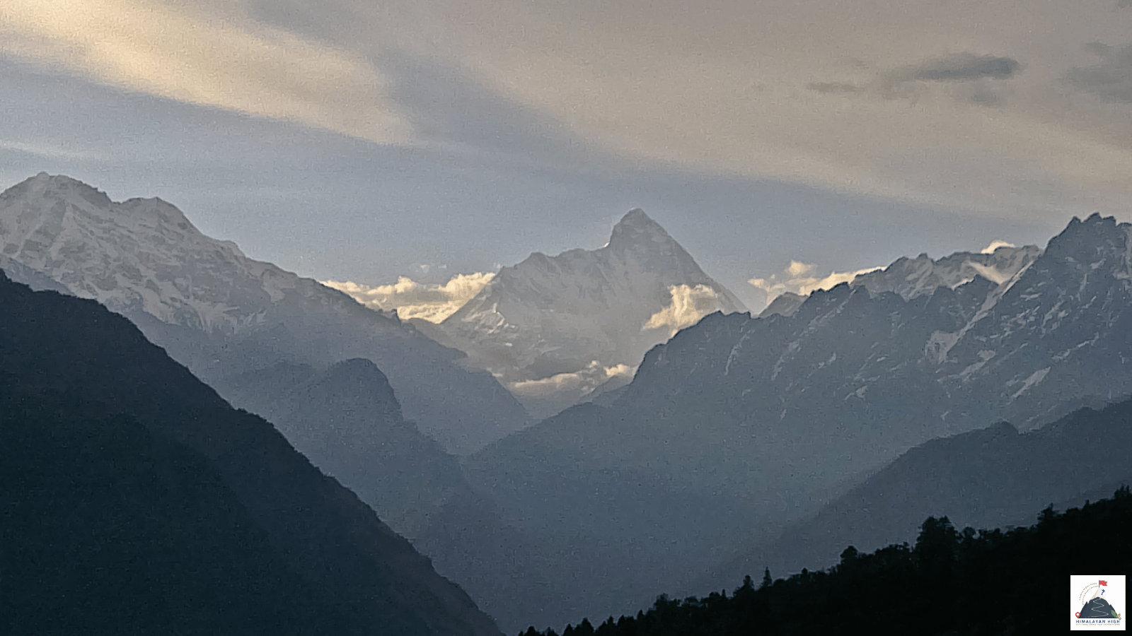
Auli is a ski resort and meadow at about 2,500 to 3,050 m above Joshimath. It is about 265 km from Rishikesh by the Badrinath highway and a steep side road; heavy snow from January to March can close that last climb.
Region: Uttrakhand - Garhwal
Route hubs: Rishikesh - Devprayag - Srinagar - Rudraprayag - Karnaprayag - Nandprayag - Chamoli - Pipalkoti - Joshimath - Auli
Nearest airport
Jolly Grant Airport, Dehradun (DED)
285.00 km • About 9.5 hr
Nearest railhead
Yog Nagari Rishikesh railway station, Rishikesh (YNRK)
265.00 km • About 9 hr
From the airport
Jolly Grant Airport (DED), which serves Dehradun, is the nearest airport, about 280 to 290 km from Auli: some 20 km to Rishikesh, then the Badrinath highway. It has several flights a day from Delhi and direct flights from Mumbai, Bengaluru, Hyderabad, Kolkata, Ahmedabad, Jaipur, Lucknow and Pune, though the timetable changes with the seasons. Taxis can be hired at the terminal.
Most flights land from mid-morning onwards and the drive takes 9 to 10 hours, so going straight to Auli means arriving after dark. Spend the night in Rishikesh or Dehradun and leave at first light. If you are flying in from abroad you will land at Delhi, about 500 km from Joshimath; connect by air to Dehradun, or by train to Haridwar or Rishikesh.
From the railway station
The nearest railhead is Rishikesh, about 265 km from Auli. Most long-distance trains now use Yog Nagari Rishikesh (YNRK), among them the Doon Express from Howrah, the Yoga Express from Ahmedabad and the Kalinga Utkal Express from Puri. The older Rishikesh station (RKSH) is close by and has fewer services. Both are within about 2 km of the main bus stand (ISBT), a short auto ride away.
Haridwar Junction (HW), about 25 km from Rishikesh, has many more trains, including the fast day trains from Delhi (Shatabdi, Jan Shatabdi and Vande Bharat). The road from Rishikesh to Auli takes another 8 to 10 hours, and about an hour more from Haridwar, so arrive the evening before. The Rishikesh–Karnaprayag railway is still being built and carries no passengers yet; its completion is now targeted for December 2029.
By road
Auli is reached along the Badrinath highway (NH7) from Rishikesh, and then by a steep side road from Joshimath. From Rishikesh the highway follows the Ganga to Devprayag (about 70 to 75 km), then the Alaknanda through Srinagar to Rudraprayag (about 140 km), and on through Gauchar to Karnaprayag (about 170 km). Beyond Karnaprayag it passes Nandprayag, Chamoli, Pipalkoti and Helang to reach Joshimath (officially Jyotirmath since 2024) at about 1,875 m, some 250 km and 8 to 9 hours from Rishikesh. Much of it is the widened Char Dham highway, but slips, repair works and pilgrim traffic still slow it.
In Joshimath you leave the highway for the Auli road, which climbs about 14 to 16 km in tight hairpins to the resort at roughly 2,500 to 3,050 m; allow 30 to 45 minutes. Door to door, Rishikesh to Auli is about 265 km and 8 to 10 hours with stops.
There is no high pass on the way, so the highway to Joshimath stays in use through the winter. In the monsoon, from late June to September, landslides can block it for hours at a time. In the snow months, January to March, heavy falls can close the last climb to Auli until it is cleared.
By bus
Buses to Joshimath leave the Rishikesh bus stand (ISBT) early in the morning, run by Uttarakhand Roadways (UTC) and the private Garhwal Motor Owners' Union (GMOU). Departures have typically been around 5 to 5:30 am from Rishikesh and 4:30 am from Haridwar, with the last useful bus by about 7 am; the ride takes 8 to 11 hours. UTC also lists routes to Joshimath from Haridwar and Dehradun, and a Haridwar–Auli route via Joshimath. Seats are limited and timings change, so check at the bus stand the day before. The buses are slow and cramped, so if you are trekking the next day a shared or private jeep is more comfortable.
Shared jeeps for the hill towns leave from Natraj Chowk, about 1 km from the Rishikesh bus stand, but few run straight through to Joshimath; expect to change at Srinagar or Rudraprayag. Coming back, GMOU buses have left Joshimath for Rishikesh and Haridwar at around 4 and 6 am.
Local transfers
Joshimath is where you change for Auli. Local taxis run up from the town, and the occasional bus goes on to Auli. The Joshimath–Auli ropeway has been shut since January 2023 because of land subsidence in Joshimath and was still closed in mid-2026, so plan on the road and ask locally whether it has reopened. After heavy snow the police have allowed only four-wheel-drive vehicles up the Auli road, and at New Year they have made visitors leave private cars in Joshimath and take local taxis. For treks that start here, you can drive up from Rishikesh in a day and sleep in Auli rather than Joshimath. Aim to reach Auli before sunset.
Distances from major points
- Jolly Grant Airport (Dehradun) to Rishikesh: about 20 km
- Haridwar to Rishikesh: about 25 km
- Rishikesh to Devprayag: about 70 to 75 km
- Rishikesh to Rudraprayag: about 140 km
- Rishikesh to Karnaprayag: about 170 km
- Rudraprayag to Joshimath: about 113 km
- Karnaprayag to Joshimath: about 80 km
- Rishikesh to Joshimath: about 250 km
- Joshimath to Auli: about 14 to 16 km
- Rishikesh to Auli: about 265 km
- Haridwar to Joshimath: about 277 km
- Dehradun to Joshimath: about 300 km
- Jolly Grant Airport to Auli: about 280 to 290 km
- Delhi to Joshimath: about 500 to 530 km
Good to know
Auli is a ski resort and meadow on the slopes above Joshimath, at about 2,500 to 3,050 m, with wide views of Nanda Devi, Kamet and Dunagiri. It is the start of the walk up to the Gorson Bugyal meadow and of treks such as Kuari Pass and Pangarchula. Snow usually covers the slopes from January to March, the skiing season, when GMVN runs ski courses and national competitions are held; for the rest of the year it is a quiet meadow base.
Stay in Auli itself (GMVN's ski resort and a number of private hotels and cottages) or in Joshimath, the last sizeable town, where you should pick up anything you have forgotten. Rooms fill quickly around Christmas, New Year and after fresh snow. Auli needs no special permit; treks beyond it, such as Kuari Pass, need forest-department entry permits, and if you go on to Badrinath in the temple season you must register for the Char Dham Yatra. A chairlift links the lower and upper slopes; check on arrival whether it is running.
Safety
Keep a spare day at the end of your trip: from late June to September landslides and sinking stretches regularly block or narrow the Badrinath highway, sometimes for many hours, and snow can close the Auli road in winter. Auli lies at about 2,500 to 3,050 m, more than 2,000 m above Rishikesh, and you climb it in a single day, so take the first evening gently and drink plenty. Avoid driving after dark, and check the road with your driver, hotel or the police each morning.
Travel tips
- Plan buffer time for road delays, especially in monsoon and winter.
- Start early for long drives to avoid night stretches on mountain roads.
- Keep offline maps and cash as backup in low-network zones.
- If you are continuing to high altitude areas, acclimatize and hydrate well.