How to reach Tso Moriri
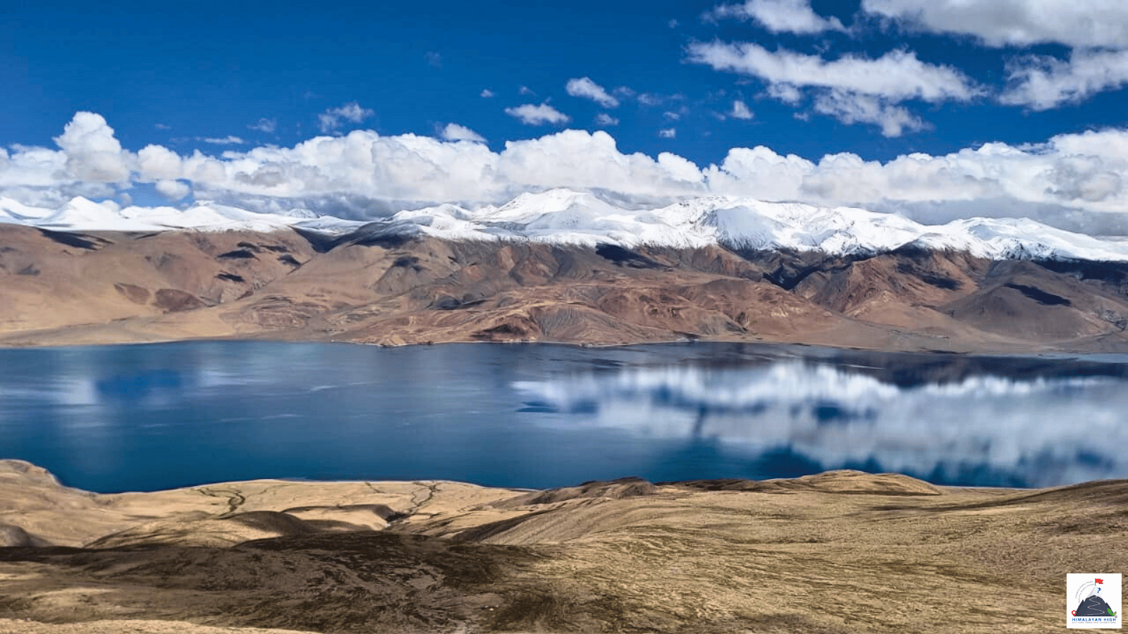
Tso Moriri lies at about 4,520 m on the Changthang plateau, some 220 to 240 km from Leh. Spend at least 48 hours in Leh before going up; no buses run to the lake, and foreign nationals need a Protected Area Permit.
Region: Ladakh
Route hubs: Leh - Karu - Upshi - Chumathang - Mahe - Sumdo - Korzok
Nearest airport
Kushok Bakula Rimpochee Airport, Leh (IXL)
230.00 km • About 6.5 hr
Nearest railhead
Srinagar railway station (Nowgam), Srinagar (SINA)
670.00 km • About 18.5 hr
From the airport
Kushok Bakula Rimpochee Airport at Leh (IXL) is the only airport with passenger flights for Tso Moriri. Air India, IndiGo and SpiceJet fly from Delhi, which has the most departures, and there are direct flights from Chandigarh, Jammu and Srinagar, with Mumbai in season. All flights operate in the morning because of the afternoon winds, and weather can delay or cancel them. Taxis are available at the terminal for the short run into Leh. Do not head for the lake on the day you land: rest in Leh first, then allow a full day for the drive of about 230 km from the airport to Korzok.
From the railway station
Ladakh has no railway. The nearest station is Srinagar (SINA), at Nowgam about 8 km from the city centre, on the Jammu to Baramulla line, open throughout since June 2025. Since April 2026 the Vande Bharat Express has run from Jammu Tawi six days a week, in about 4 hours 50 minutes. From Srinagar it is about 434 km by road to Leh via Sonamarg, Zoji La, Drass and Kargil, normally two days with a night in Kargil: JKSRTC runs a morning bus from the Tourist Reception Centre in Srinagar that halts overnight in Kargil, and taxis ply the road in season. Zoji La is now kept open far longer into winter than it once was, but snow can still shut it for days or weeks, mostly between January and April, and the Zojila tunnel is not yet open. After resting in Leh, Korzok is one more long day, so allow about 670 km and three driving days from the station. If Zoji La is shut, take a train to Jammu Tawi or Chandigarh and fly to Leh.
By road
Most travellers come from Leh along the Indus. The road runs past Shey and Thiksey to Karu, about 35 km, and on to Upshi, where the Manali road turns off south. Stay on the Indus road to Chumathang, about 140 to 155 km from Leh, then carry on to Mahe, cross the Indus at Mahe bridge and turn south to Sumdo. The last stretch, about 40 to 53 km, climbs across the open Changthang plateau to Korzok, the village on the lake's north-west shore. In all it is about 220 to 240 km and 6 to 7 hours of driving, on a road surfaced throughout since about 2023.
The other route follows the Manali road from Upshi over Taglang La (5,328 m) to the Morey Plains, then turns east past Tso Kar and over Polokongka La to Puga and Sumdo: about 240 km, with about 10 km still unsurfaced between Tso Kar and Sumdo in 2023. Travellers coming up from Manali join it on the Morey Plains. The Manali road is closed by snow from about November to May and October can bring snow to the Tso Kar section, so outside summer keep to the lower Indus road. From Pangong, Indian travellers can also drive via Chushul, Nyoma and Mahe; foreigners have not usually been permitted beyond Man and Merak on Pangong.
Local transfers
No buses run to Tso Moriri, so most visitors hire a taxi in Leh through their hotel or a travel agent, often for a two-day trip with a night at Korzok. Rest in Leh first. For Mentok Kangri, base camp is reached on foot from Korzok. Rumtse to Tso Moriri trekkers walk in and finish at Korzok Phu, then drive back to Leh via Chumathang, and Parang La trekkers cross on foot from Spiti and drive back via Mahe bridge. Leave Leh early to reach Korzok in daylight, with time for the hot springs at Chumathang.
Distances from major points
- Leh to Karu: about 34 to 36 km
- Karu to Upshi: about 13 to 14 km
- Leh to Chumathang: about 140 to 155 km
- Chumathang to Korzok via Mahe bridge and Sumdo: about 75 to 85 km
- Sumdo to Korzok: about 40 to 53 km
- Leh to Korzok via Chumathang: about 220 to 240 km (6 to 7 hours)
- Leh to Korzok via Taglang La, Tso Kar and Polokongka La: about 240 km
- Srinagar to Leh via Zoji La and Kargil: about 434 km (two days)
- Manali to Leh via the Atal Tunnel: about 428 to 431 km (usually open from about May or June to October)
Good to know
Tso Moriri lies about 4,520 m above sea level on the Changthang plateau and is protected as the Tso Moriri Wetland Conservation Reserve, a Ramsar site where bar-headed geese and black-necked cranes breed. Stay the nights before in Leh. Chumathang, with a guesthouse, homestays and hot springs, is a lower place to break the journey, and Korzok has simple homestays and guesthouses, some of which close early in October.
Indian citizens no longer need an Inner Line Permit, but must pay the Leh district environment, Red Cross and wildlife fees on the official LAHDC Leh permit portal or through a Leh travel agent, and should carry copies with photo ID for the checkposts at Mahe and before Korzok. Foreign nationals need a Protected Area Permit, arranged through a registered travel agent in Leh; citizens of China, Pakistan and Afghanistan need Home Ministry clearance.
Fill up with fuel in Leh or at Karu. Chumathang has had 4G coverage since 2022, but beyond it expect little or no signal. Tents are not allowed close to the water and there is only one camping site at the lake, so camp only there and keep to the tracks in this protected wetland.
Safety
Korzok stands at about 4,500 to 4,600 m, more than 1,000 m above Leh, so a night by the lake is hard on anyone not yet acclimatised. The Leh administration asks visitors to spend at least 48 hours in Leh before going higher; if a headache or breathlessness worsens, go down to Chumathang (3,950 m) or Leh. The usual season is May to September; October nights drop well below freezing and can bring snow to the Tso Kar route. Ask about the road in Leh and at the Mahe checkpost, and keep a spare day before any flight home.
Travel tips
- Plan buffer time for road delays, especially in monsoon and winter.
- Start early for long drives to avoid night stretches on mountain roads.
- Keep offline maps and cash as backup in low-network zones.
- If you are continuing to high altitude areas, acclimatize and hydrate well.