How to reach Pangong Lake
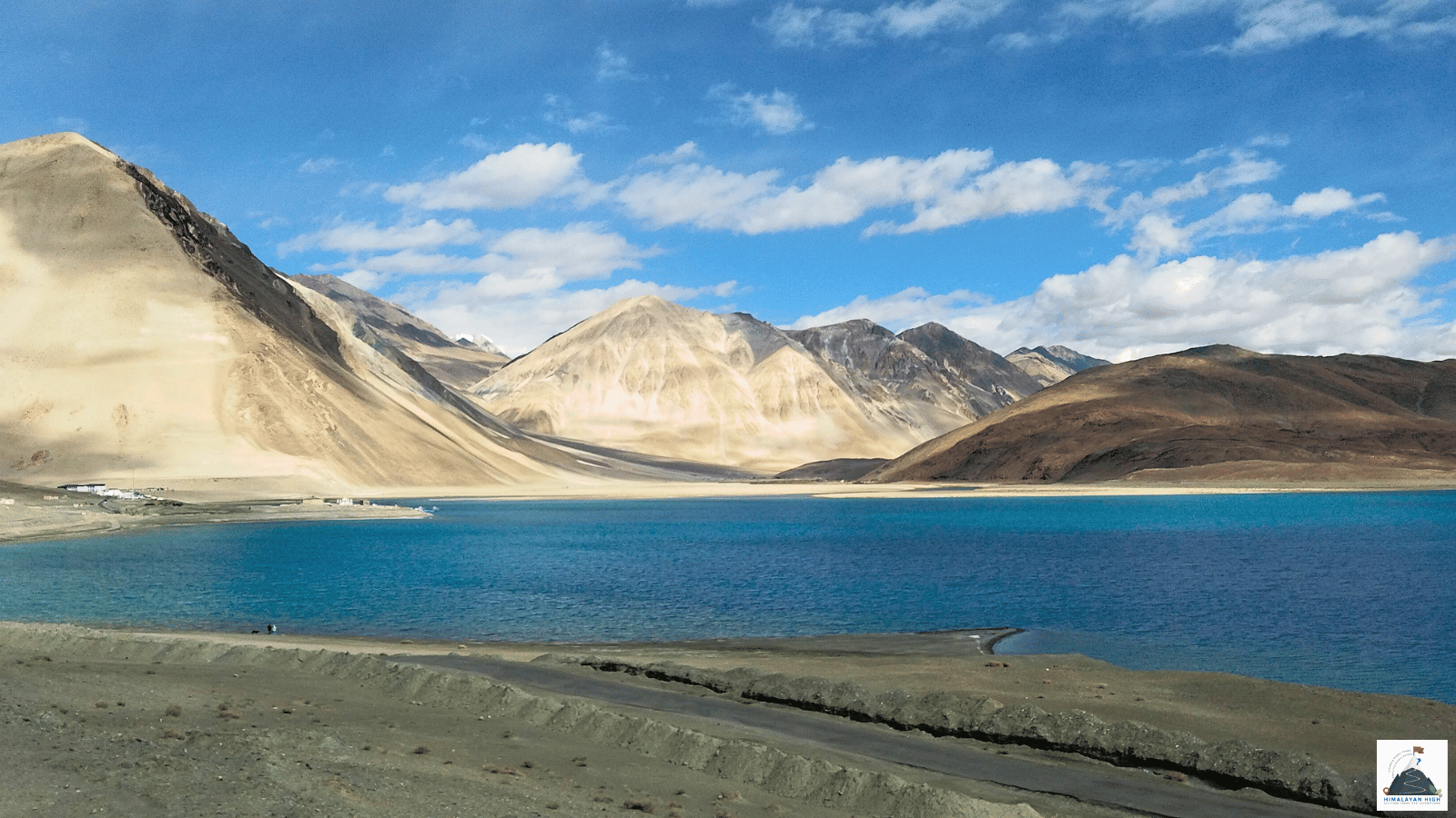
Pangong Lake lies at over 4,200 m, reached from Leh by road over Chang La (about 5,360 m). Rest in Leh for at least 48 hours first, and draw cash and fill up with fuel there: the lake has no ATM and no fuel.
Region: Ladakh
Route hubs: Leh - Karu - Sakti - Chang La - Durbuk - Tangtse - Lukung - Spangmik
Nearest airport
Kushok Bakula Rimpochee Airport, Leh (IXL)
165.00 km • About 6 hr
Nearest railhead
Srinagar railway station (Nowgam), Srinagar (SINA)
595.00 km • About 18 hr
From the airport
Kushok Bakula Rimpochee Airport at Leh (IXL) is the only practical airport. Delhi has daily flights through the year, and there are direct flights from Chandigarh, Jammu and Srinagar, plus Mumbai in season. Flights land only in the morning because of strong afternoon winds, and bad weather can delay them. The airport is about 5 km from Leh town: prepaid taxis run from the terminal. Do not drive on to Pangong the day you land, as the Leh administration asks every visitor to rest for at least 48 hours first. From the airport the lake is about 165 km, 5 to 7 hours by road. In winter the Manali road is closed for several months and snow can shut Zoji La on the Srinagar road for days or weeks, so flying is then the most reliable way in.
From the railway station
Ladakh has no railway. The nearest station is Srinagar (SINA), at Nowgam about 8 km from the city centre, which has been linked by rail to Jammu since the Jammu to Baramulla line was completed in June 2025. From Srinagar it is about 434 km by road to Leh via Sonamarg, Zoji La, Drass and Kargil, usually two long days with a night in Kargil, and then about 160 km more to Pangong: close to 600 km in all. Buses and private taxis run between Srinagar and Leh while the road is open, and the gradual climb helps you adjust to the altitude. Zoji La is closed by snow for part of every winter and the Zojila tunnel is still under construction, so check that the pass is open before you plan on this route. Out of season, take a train to Jammu Tawi or Chandigarh and fly to Leh from there.
By road
Pangong is reached from Leh over Chang La. Leave Leh on the Manali highway past Shey and Thiksey to Karu, about 35 km, where the Pangong road turns off to the north-east. It passes Sakti about 10 km on and climbs a long series of bends to Chang La (about 5,360 m), roughly 75 to 80 km from Leh. The descent runs about 32 km to Durbuk and 9 km more to Tangtse, then 35 to 38 km up the valley past Muglib to Lukung, where the lake comes into view. Spangmik lies a few kilometres further along the southern shore, about 160 km and 5 to 7 hours from Leh; Man and Merak are roughly 20 km beyond.
Most of the road is surfaced, but for 10 to 15 km either side of Chang La it turns to loose dirt and slush after winter, and meltwater streams cross it in summer. The pass is usually kept open through the winter, though fresh snow can close it for hours or days. From about May to October a second road links Pangong with Nubra: from Durbuk it drops to the Shyok river and follows it past Shyok village and Agham to Khalsar, about 160 to 175 km and 5 to 7 hours between Hunder or Diskit and Spangmik.
By bus
Jammu and Kashmir State Road Transport Corporation (JKSRTC) buses leave the Leh bus stand for Spangmik in the summer season. Recent timetables show departures at about 6 am at weekends, taking 7 to 8 hours, with the bus staying the night at the lake and returning early the next morning; other reports mention only a Sunday bus. Buses to Chushul and Phobrang on a few days a week also pass through Tangtse. Tickets are sold only at the counter, so buy them the evening before and confirm the day and time there, as timings change.
Local transfers
Almost all transport to Pangong starts in Leh. Travelling on your own, hire a taxi from the Leh taxi stand, which works to a fixed rate list, or ask a Leh travel agent to fit you into a shared taxi for the usual two-day round trip, out one day and back the next. Start by about 7 am so you reach the lake with daylight to spare, and give the driver the name and village of your camp or homestay, as they are spread along some 20 km of shore.
Distances from major points
- Leh to Karu: about 35 km
- Karu to Sakti: about 10 km
- Sakti to Chang La: about 32 to 34 km
- Chang La to Durbuk: about 32 km
- Durbuk to Tangtse: about 9 km
- Tangtse to Lukung: about 34 to 38 km
- Leh to Lukung: about 150 to 155 km (5 to 6 hours)
- Leh to Spangmik: about 155 to 170 km (5 to 7 hours)
- Spangmik to Merak via Man: about 20 to 23 km
- Hunder or Diskit to Spangmik via the Shyok road: about 160 to 175 km (5 to 7 hours)
- Srinagar to Leh via Zoji La and Kargil: about 434 km (two days)
- Manali to Leh via the Atal Tunnel: about 430 km (two days, usually open from May or June to October)
Good to know
Pangong Tso is a long, brackish lake at over 4,200 m that runs east into Tibet; about a third of it lies in India. Stays are in the villages along the southern shore, mainly Spangmik, with quieter camps and homestays at Man and Merak. Camping on the lakeshore itself is banned, so licensed camps sit back from the water. Spend the nights before in Leh, which has the widest choice of hotels and guesthouses, and draw cash there: there is no ATM at the lake.
Indian citizens have not needed an Inner Line Permit since 2021, but must pay the environment fee, Red Cross fund and wildlife fee on the official Leh permit portal or through a registered Leh travel agent; keep a copy with your photo ID. Foreign nationals need a Protected Area Permit arranged through a registered Leh travel agent, and citizens of China, Pakistan and Afghanistan need Home Ministry clearance.
Camps open from about June and pack up by mid-October. In winter, when the lake freezes, almost nothing at the lake stays open, and Tangtse, about 35 km before the lake, has basic homestays. Fill up with fuel in Leh or at Karu; there is no fuel at the lake. Mobile signal is patchy (BSNL and Jio are the likeliest to work), and prepaid SIMs from outside Jammu and Kashmir and Ladakh do not work here, so bring a postpaid connection. Boating is not allowed on the lake.
Safety
You cross Chang La at about 5,360 m and sleep at over 4,200 m, some 700 to 800 m higher than Leh, so finish your rest days in Leh first, keep the stop on the pass to about 20 minutes and turn back if a headache or breathlessness gets worse. Nights at the lake are close to freezing even in midsummer and well below it from September. High meltwater and landslides cut the Shyok road at times, mostly in July and August. Keep a spare day before any flight out of Leh and ask locally about the road.
Travel tips
- Plan buffer time for road delays, especially in monsoon and winter.
- Start early for long drives to avoid night stretches on mountain roads.
- Keep offline maps and cash as backup in low-network zones.
- If you are continuing to high altitude areas, acclimatize and hydrate well.