The pristine and holy lake of Nandi Kund
Though, it is not an easy trek, and is a bit strenuous trek, on the other hand, it is not a technical trek as well which makes it doable for any trekker who is physically fit and likes the challenges offered by the Himalayas. The trek involves steep climbs and descends, and some of the patches have no defined trail. Especially, the trek from Kachni Khal to Pandavsera is very easy to get lost without a sound local guide and an expert team. The climb up to the top of the Ghiya Vinayak Pass adds further to make the Nandikund - Ghiya Vinayak Pass trek one of the lesser-known treks in the Himalayas of Garhwal, and thankfully so.
Chowkhamba - The Guiding Light Of The Nandi Kund Trek
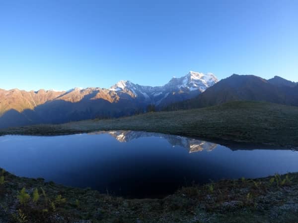
The Chowkhamba Massif dominates the trek to Nandikund for almost 5 days. The best view can be seen from the Buda Madhyamaheshwar where there are over 7 small lakes that reflect the beautiful peak on its surface. From Madhyamaheshwar, it's about 30 minutes climb up to the top of Buda Madhyamaheshwar. The best time to be there is during the sunrise and sunset. Even the peaks of Mandani look beautiful from here.
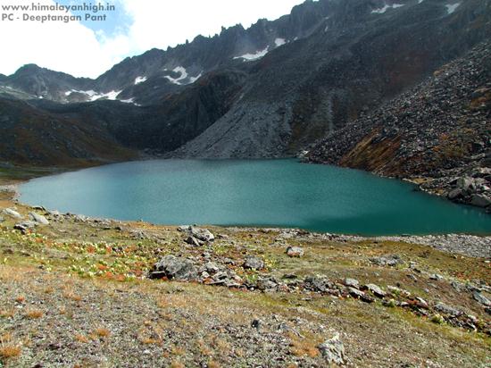
Nandi Kund - A Pristine Lake
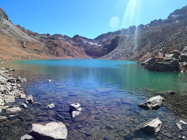
The beauty of this lake cannot be expressed in words. It is not the lake that looks beautiful, but the entire ambience around the place is unforgetful. There is a positive spirit around which uplifts your soul as soon as you get a sight of it. You feel as if you should never leave this place. The turquoise green colour of the lake water with its slow waves settles your heart right into it. You could keep watching the waves and get lost in your own world. The rocky surrounding and gushing wind just add up to the feel.
Ghiya Vinayak Pass - A Thrilling Climb
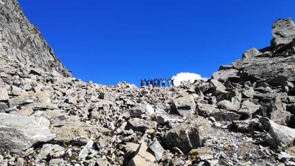
The walk to the top of Ghiya Vinayak pass is not just treacherous through the moraines, but also extremely beautiful and thrilling at the same time. The trail is over the rocky moraine and keeps changing with each season. You need to be extra cautious with every step. A good support team helps a lot or else you might completely lose your way and get lost.
Nanda Devi - From The Nandi Kund Trek
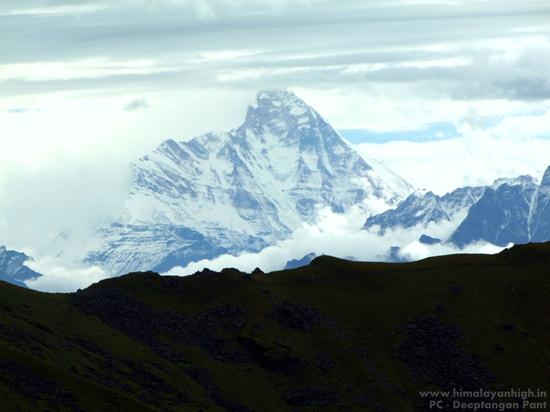
Nanda Devi - The Goddess Mountain stands right in front of you when you climb up the Ghiya Vinayak Pass. Nanda Devi is the highest self-owned peak in India which was once thought to be the Worlds tallest peak until Everest was discovered. The mere sight of this Godly signature mountain is indeed a blessing. The same mountain is also seen from the village of Urgum.